Showing posts with label Richmond-San Rafael Bridge. Show all posts

Monday, August 19, 2013

San Rafael, Shoreline Park - Mar. 3, '13

Walking Distance: 3 mi. (estim.)
Walking Time: 1 hr., 39 min. (4:31 - 6:10 p.m.)
Start and End Point: street parking near entrance to Jean and John Starkweather Shoreline Park

While I am walking around the Bay in a clockwise direction, I occasionally skip segments and then go back to walk them later. After hiking the southern end of China Camp State Park last week, today I backtracked (south) to walk a stretch of Shoreline in San Rafael that I missed.

This area was north of the Richmond-San Rafael Bridge (and San Quentin Prison), and south of China Camp and McNears Beach, and included a few miles of scenic shoreline trails (some paved and some packed dirt). Today's stretch is shown as solid, dark green (asphalt) and medium green (packed dirt) lines on the 2012-2013 Bay Trail Map set.

This afternoon's walk at Jean and John Starkweather Shoreline Park was a beautiful one by the Bay, with a winter bonanza of ducks -- more than 200 sighted in less than 2 hours, and great views of the Bay, the Richmond-San Rafael Bridge, and Mount Tamalpais.

The entrance to this trail was located at the NE end of Bellam Blvd., marked by a sign (Jean and John Starkweather Shoreline Park). I followed a paved (asphalt) path toward the Bay and headed north.

Along the way I could see the Richmond - San Rafael Bridge to the southeast, two small islands in the Bay (part of Marin Islands National Wildlife Refuge). These islands are home to egrets and other nesting birds.

I walked north until I reached a small point and turned around. I then walked south, along a packed earth path for some of that time, then a paved path again, passing some light industrial/office buildings. At the south end of this stretch I reached a small beach. I sat down on a large driftwood log to watch birds for a moment. A gate blocked shoreline access further south (toward a shooting range and San Quentin).

On the return walk (north) back to the car, the sun was setting in the west and I enjoyed watching Mount Tamalpais turn into a dark and beautiful silhouette, surrounded by the sunset.

Wildlife Sightings:
209 ducks, including 20 lesser scaups; 24 little brown jobs (LBJs); 2 red-winged blackbirds; 2 UFO grebes; 4 Canada geese; 4 unidentified brownish shorebirds (UBBs); 7 crows/ravens; 5 bumblebees; 5 black-necked stilts; 1 killdeer; 1 coot; 1 cormorant; 3 sea gulls; 2 mockingbirds; 2 doves

Thursday, August 1, 2013

Paradise Drive, Triangle Marsh - Dec. 24, '12

Walking Distance: 1.8 mi.
Walking Time: 47 min. (4:18 - 5:05 p.m.)
Start and End Point: side of road, Paradise Drive, Tiburon, CA

For me, there is no better way to celebrate the holidays than to enjoy a walk between festivities. I returned to Paradise Drive for another late afternoon walk -- once again trying to eke out as much daylight time as possible before sunset.

Sometimes you have to squeeze in walking time whenever you can find it during the day. And daytime is the best time for walking or riding on Paradise Drive (not technically part of the SF Bay Trail, and shown as a dotted, dark green line on the newest 2012 - 2013 Bay Trail Maps), due to stretches of winding road through trees, with limited set-backs. However, views of San Quentin, the Richmond - San Rafael bridge, and boats passing below help justify this walk.

I started this afternoon's amble by heading south on Paradise Drive to Ranch Drive (where I'd ended my previous walk last week). I then walked down (and back up) Ranch Drive, back to Paradise Drive.

Along the way, I enjoyed bright spots of winter color. Red berries, evergreen trees and green foliage -- perfect for Christmas week in Northern California, along with interesting mosses and lichens on rocks.

After turning around, I then headed North. I passed my parked car along the way, and continued north on Paradise Drive. I felt I was returning to civilization, or at least a more urban setting. I passed Marin Montessori, and Marin Country Day School (MCDS), and was able to walk on sidewalks for part of the time.

At the other (north) end of today's loop walk, I turned around at the intersection of Paradise Drive and Westward Drive, near the city boundary (cross-over point for me), between Tiburon and Corte Madera.

I enjoyed passing Triangle Marsh, at the base of Ring Mountain on the Tiburon peninsula, where I returned to the shoreline, after enjoying the views from above for the past few weeks, up in the hills and trees. I was rewarded by the sight of a few black-necked stilts (shorebirds) in the marsh, and the sight of a rising moon.

Wildlife Sightings:
2 crows; 3 sea gulls; 3 little brown jobs (LBJs); 2 robins; 3 black-necked stilts


Paradise Drive, continued - Dec. 19, '12

Walking Distance: 1.15 mi.
Walking Time: 24 min. (4:08 - 4:32 p.m.)
Start and End Point: Side of paved road, Antilles Way, Tiburon, CA

Today was another short walk on a December afternoon with clear skies, due to getting out late and the sun setting early. Sadly, as I walk further north along the San Francisco Bay Trail (and toward the farthest point away from my home), more time is spent on driving and less on walking when the days are shorter.

I have been trying to walk stretches of Paradise Drive (not technically part of the developed Bay Trail and shown as a dotted line on 2012-2013 Bay Trail map set) for a few weeks now. However, it's not a stretch of road I hike after dusk, due to narrow setbacks and cars and bicycles that tend to appear suddenly around corners.
However, today's section of Paradise Drive was a bit safer than previous sections.

Some areas had wider setbacks, and today I was actually walking on a cement sidewalk (something I hadn't seen in awhile). Generally a sign that I'm returning to a more developed area.

Sights included a scenic view of San Quentin prison; the Richmond - San Rafael Bridge, a housing development down by the water (Paradise Cay); and interesting rocks and trees.

I walked until I reached the intersection of Ranch Road and Paradise Drive, before turning around and heading back. 

I smiled as I passed carports on Paradise Drive with million dollar views of the Bay. (These carports were, arguably, nicer than my entire house.)  

I continued (roughly southeast) along Paradise Dr., past Antilles Way then to far end of Antilles Way where it rejoined Paradise Dr. 

And, through the trees, I caught sight of East Brother Light Station, located on a small island in the bay with a Victorian Bed and Breakfast that will accommodate overnight visitors (by reservation only). The two Brother islands (East and West) could be glimpsed in the far distance, through/under the Richmond - San Rafael Bridge.

Wildlife Sightings:
2 little brown jobs (LBJs)


Sunday, July 21, 2013

Paradise Dr., Solano St. - Nov. 3, 2012

Walking Distance: 4.7 mi.
Walking Time: 2 hrs., 4 min. (4:10 - 6:14 p.m.)
Start and End Point: street parking, near 2355 Paradise Dr., Tiburon, CA

This late fall afternoon, I continued my walk along Paradise Drive in Tiburon, until evening shadows made it difficult to continue. This stretch of Paradise Drive, in fact most of Paradise Drive, on the north side of the Tiburon peninsula in Marin County, is shown as a dotted dark green line on the San Francisco Bay Trail map.

There were still a few carved pumpkins from Halloween on porches of houses I passed. The weather had gotten a bit cooler this week, and the easy days of summer, with evenings that stayed light until almost 9 p.m. were but a memory now.

However, what today's late-afternoon-into-early-evening walk lacked in trail amenities (such as setbacks) and daylight, it more than made up for in scenery, with views of Angel Island (including a clear view of the old red brick army hospital building up on the hill across the strait), Keil Cove, Golden Gate Bridge, Sutro Tower and the skyline of San Francisco, the Port of Oakland, Richmond-San Rafael Bridge, San Quentin Prison, and boats in the Bay: ferry boats, sailboats and various motorized ships.

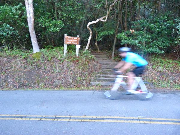
I walked north on Paradise Drive, and passed the County of Marin Tiburon Uplands Nature Preserve trailhead (a small sign and a set of stairs disappeared into the wooded hillside). A minute later I walked past the Romberg Tiburon Center gate, and and soon thereafter, the Bay Conference Center.


I took lots of pictures of the winding, narrow, tree-lined stretches of Paradise Drive. I stopped occasionally to shoot pictures of items perched precariously on a narrow strip of earth adjacent to the asphalt. This time of year there were plenty of berries, acorns, chestnuts, new tiny green shoots starting to push up from the ground, and the occasional banana slug.

I would have liked to have walked a bit more, but cars and bicyclists have a difficult enough time seeing pedestrians in the daytime on roads like this. Best not to alarm them unexpectedly with your presence at dusk.

I turned around at 3333 Paradise Dr. Toward the end of my walk back, about a half hour before sunset, I enjoyed glimpses of small, pretty coves and sailboats, and golden cliffs, visible between dark, silhouetted trees.

On the way back, I took a slight detour and walked downhill Mar Centro/to Mar East street sign, to a cluster of mailboxes, where I'd stopped on a previous walk. Then I headed back up to Paradise Dr., past my car, to the intersection with Solano Street, where I turned around to walk back to my car again. But, not before spending several minutes admiring the Golden Gate Bridge in the distance, with the sun setting behind it.

Wildlife Sightings:
3 butterflies/moths; 2 little brown jobs (LBJs); 1 banana slug