Thursday, July 25, 2013

Paradise Drive - Dec. 9, 2012

Walking Distance: 2.4 mi.
Walking Time: 43 min. (3:45 - 4:28 p.m.)
Start and End Point: Side of road (dirt pull-out area), near 4151-4185 Paradise Drive, Tiburon, CA

December afternoons fade into darkness rather quickly, so this was a(nother) short walk along Paradise Drive in Tiburon.

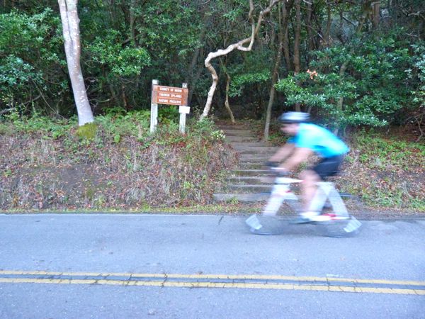
Shown as a dotted, dark green line on the new set of Bay Trail maps, this road is not part of the completed/improved Bay Trail. So, walk with caution. Keep an eye out for cyclists and cars, and stick to the edge of the road, and you should be rewarded with views of Paradise Cove and the Bay along this stretch of Paradise Drive. And, today (a clear day), the Richmond-San Rafael Bridge and the East Bay area cities (Richmond refineries down to Albany) were visible as well.

I walked southeast along Paradise Drive to the point where I'd left off yesterday, and turned around to walk back toward where I parked. Walking in a loop (as I usually do), I passed my car, and continued walking (northwest) as far as 4220 Paradise Dr., to a pull-out area with a wood fence. Here, I turned around and hustled to make it back to the car while there was still some light left in the day.

A handful of cars and a few bicyclists whizzed by me, but otherwise I enjoyed a peaceful walk by myself. I spotted a few deer. One was doing its best to appear to be invisible behind a bush. Pedestrians are relatively rare on this winding, relatively rural road, and the deer were a bit wary. I can't blame them for wondering what I was doing there at dusk (not an advisable time of day to be walking on a curvy road with narrow setbacks).

Wildlife Sightings:
9 little brown jobs (LBJs); 2 deer

Wednesday, July 24, 2013

Paradise Beach Park - Dec. 8, 2012

Walking Distance: 2.4 mi.
Walking Time: 1 hr., 22 min. (3:45 - 4:35 p.m., and 4:39 - 5:11 p.m.)
Start and End Point: Paradise Beach Park, 3450 Paradise Drive, Tiburon, CA

This afternoon I continued to follow Paradise Drive (located on the north side of the Tiburon peninsula), shown as a dotted dark green line on the new San Francisco Bay Trail Map set. I would not recommend walking here unless you feel comfortable walking on very narrow setbacks and around potentially blind corners.

However, I did enjoy scenic views of the Richmond-San Rafael Bridge, the Bay, and ships passing by;  and there was a nice county park to explore. Also, the California Buckeye trees were dropping large, interesting looking (chestnut-like) seeds by the roadside -- fun to examine if you're a plant/tree lover. Some of these were germinating/sprouting in place giving them an alien look.

I started my walk, by ambling downhill to the fishing pier in the park. (Note: Paradise Beach Park, a Marin County park, was, except for the fishing pier, closed to the public, the day I was there, due to shorter winter hours, and likely budget cutbacks.) After a quick walk around the pier area, I walked back uphill and left the park to walk along Paradise Drive.

I first walked southeast to 3333 Paradise Drive (where I'd ended a previous walk). After I reached this point, I turned around and walked back (northwest, passing the park) as far as the No. 4 Mailbox on Paradise Drive, near 3825 and 3700 Paradise Drive. Sunset followed by inevitable darkness forced me to call it a day. (I would not advise walking on Paradise Drive at dusk or in the dark.) So, I turned around and I walked back to my car at Paradise Beach Park.


As I returned to my car in the parking lot, I looked down to fish out my car keys from my pack. I glanced up again, and froze. There was a beautiful buck (deer) with large antlers standing inches from my car. For a brief moment we just stared at each other at close range. If I'd moved an inch (to take a picture), I'm sure he would have bolted. So, I'm reduced to a mere mention of this encounter here. I only photographed "small game" today (banana slugs and small birds).

Wildlife Sightings:
2 pigeons; 1 sea gull; 1 Western/Clark's grebe; 2 banana slugs; 7 little brown jobs (LBJs); 1 blue jay; 1 deer (with full set of antlers, standing next to my car)


Sunday, July 21, 2013

Paradise Dr., Solano St. - Nov. 3, 2012

Walking Distance: 4.7 mi.
Walking Time: 2 hrs., 4 min. (4:10 - 6:14 p.m.)
Start and End Point: street parking, near 2355 Paradise Dr., Tiburon, CA

This late fall afternoon, I continued my walk along Paradise Drive in Tiburon, until evening shadows made it difficult to continue. This stretch of Paradise Drive, in fact most of Paradise Drive, on the north side of the Tiburon peninsula in Marin County, is shown as a dotted dark green line on the San Francisco Bay Trail map.

There were still a few carved pumpkins from Halloween on porches of houses I passed. The weather had gotten a bit cooler this week, and the easy days of summer, with evenings that stayed light until almost 9 p.m. were but a memory now.

However, what today's late-afternoon-into-early-evening walk lacked in trail amenities (such as setbacks) and daylight, it more than made up for in scenery, with views of Angel Island (including a clear view of the old red brick army hospital building up on the hill across the strait), Keil Cove, Golden Gate Bridge, Sutro Tower and the skyline of San Francisco, the Port of Oakland, Richmond-San Rafael Bridge, San Quentin Prison, and boats in the Bay: ferry boats, sailboats and various motorized ships.

I walked north on Paradise Drive, and passed the County of Marin Tiburon Uplands Nature Preserve trailhead (a small sign and a set of stairs disappeared into the wooded hillside). A minute later I walked past the Romberg Tiburon Center gate, and and soon thereafter, the Bay Conference Center.


I took lots of pictures of the winding, narrow, tree-lined stretches of Paradise Drive. I stopped occasionally to shoot pictures of items perched precariously on a narrow strip of earth adjacent to the asphalt. This time of year there were plenty of berries, acorns, chestnuts, new tiny green shoots starting to push up from the ground, and the occasional banana slug.

I would have liked to have walked a bit more, but cars and bicyclists have a difficult enough time seeing pedestrians in the daytime on roads like this. Best not to alarm them unexpectedly with your presence at dusk.

I turned around at 3333 Paradise Dr. Toward the end of my walk back, about a half hour before sunset, I enjoyed glimpses of small, pretty coves and sailboats, and golden cliffs, visible between dark, silhouetted trees.

On the way back, I took a slight detour and walked downhill Mar Centro/to Mar East street sign, to a cluster of mailboxes, where I'd stopped on a previous walk. Then I headed back up to Paradise Dr., past my car, to the intersection with Solano Street, where I turned around to walk back to my car again. But, not before spending several minutes admiring the Golden Gate Bridge in the distance, with the sun setting behind it.

Wildlife Sightings:
3 butterflies/moths; 2 little brown jobs (LBJs); 1 banana slug


Thursday, July 18, 2013

Lyford Tower, Tiburon - Oct. 26, 2012

Walking Distance: 2.8 mi. (estimate)
Walking Time: 2 hrs., 28 min. (1:25 - 3:53 p.m.)
Start and End Point: Railroad History Museum, Tiburon, CA

Tiburon (like many cities on the Bay) has several interesting historical landmarks. I visited two of these points of interest during today's loop walk -- that included great views of the Bay, Angel Island, the San Francisco skyline and the Golden Gate Bridge. I started this afternoon's amble with a visit to the Railroad and Ferry Depot Museum, located on the water, a short walk from the Tiburon ferry terminal. 

From the railroad museum I walked back into downtown Tiburon, passing the ferry terminal, and had a salad at Guaymas (restaurant and bar) out on the patio. October can be wonderful weather month on the Pacific coast and San Francisco Bay; and today, eating lunch under a sun umbrella on a sparklingly blue and beautiful day, I counted my blessings. 


I stopped briefly at The Candy Store, after lunch, to buy a few chocolate pumpkins, then turned around and headed north to start my walk. I passed by the railroad museum and made a quick stop at Elephant Rock (near The Caprice Restaurant), then continued north on Paradise Drive -- a winding and scenic drive on the north side of the Tiburon peninsula.


Note: Most of Paradise Drive (shown as a dotted green line on map) is not part of the completed/improved Bay Trail, in part due to blind corners and narrow setbacks around turns ahead. Today's stretch, however, had some sidewalks, and would be fine if I kept to the edge of the road. 


The second historic point of interest I visited in Tiburon was the Lyford Tower, a bit further up Paradise Drive. A round, stone structure with open "windows" facing Angel Island and looking out/down onto San Francisco Bay, it's worth a quick stop.


After a bit, I made a short detour and turned right to follow Mar East Street, almost to the end (momentarily leaving Tiburon city limits). I then walked back to Paradise Drive, and turned around when I reached the intersection with Solano Street. A deer grazed up on a nearby hillside.

On the walk back, I enjoyed a conversation with a cartoonist/illustrator and his wife I met who were walking in the same direction, south on Paradise Dr. We followed sidewalks and hugged the road's edge in areas where sidewalks weren't available, as there wasn't room for us to walk side-by-side. 


Wildlife Sightings:

6 pigeons; 5 crows; 23 sea gulls; 8 cormorants; 2 brown pelicans; 2 blue jays; 1 domestic cat; 2 little brown jobs (LBJs); 1 deer

Saturday, July 13, 2013

Tiburon, Belvedere - Oct. 19, 2012

Walking Distance: 8.3 mi.
Walking Time: 5 hrs., 47 min. (11:08 a.m. - 4:55 p.m. - includes 1 hour lunch, photo stops)
Start and Stop Point: Blackie's Pasture parking lot, Tiburon, CA

Today was a long walk, along the Tiburon peninsula, a beautiful stretch of the San Francisco Bay Trail with a well-developed walking and bicycling corridor. This segment offered, on a clear day, views of the San Francisco skyline and Angel Island to the south/southeast, and Richardson Bay, Sausalito and Mt. Tamalpais to the west/northwest. You may also, weather permitting, catch a glimpse of the Golden Gate Bridge.

I walked this (solid green line* trail) with Mark Sommer, founder of Cocoa Rustica and radio host. We started this walk, in light misty weather, at Blackie's Pasture parking lot (Tiburon Boulevard and Trestle Glen Blvd.), and followed a paved (asphalt) walkway southeast toward Belvedere. Standing in open grass pasture space was a bronze statue of Blackie, the area's namesake. Blackie was a popular horse that, on a bet, successfully swam across the Bay from Marin to Crissy Field (San Francisco) in 1938.

After walking southeast for a few miles the sun came out. We passed a kayak beached for a few moments on the shore, which got us thinking about possibilities for a walk + kayak on the Bay Trail (and new Water Trail). We chose to take a detour, to walk through Belvedere (not part of the Bay Trail), including a walk up to the hilltops of this small, but exclusive, peninsula community. The walk was beautiful and quiet (enough to say hello to a deer without it immediately bolting); and the views through the trees were fairly sweeping.

After making our way downhill and making a few stops on Main Street, in downtown Tiburon, we stopped at Sam's Anchor Cafe, for lunch outside on the water. A few sea gulls eyed us and other diners from a polite distance (for sea gulls that is), hoping for a tidbit or two. Had we lived locally, we could tied up at the dock, or caught a water taxi from the dock, back home.

After lunch we walked the Bay Trail back (northwest) to Blackie's Pasture.

Toward the end of the walk, I lagged behind (happens often) to photograph some mallard ducks in a pond, and was glad I did. Shades of emerald green, in the vegetation and on the ducks, were striking.

Wildlife:
17 cormorants; 31 ducks; 2 coots; 12 crows; 3 little brown jobs (LBJs); 1 hummingbird; 1 deer; 8 brown pelicans; 13 sea gulls; 5 Western/Clarks grebes; 1 UFO grebe; 8 pigeons

*The 2013 Bay Trail Map Set has adopted a green line system to indicate developed (solid green line v. the old solid red line shown on older Bay Trail maps) vs. lesser developed or planned trail segments (dotted/broken green lines vs. dotted and double yellow lines). I will be referencing this new map system in the future.