Showing posts with label Golden Gate Bridge. Show all posts

Sunday, July 21, 2013

Paradise Dr., Solano St. - Nov. 3, 2012

Walking Distance: 4.7 mi.
Walking Time: 2 hrs., 4 min. (4:10 - 6:14 p.m.)
Start and End Point: street parking, near 2355 Paradise Dr., Tiburon, CA

This late fall afternoon, I continued my walk along Paradise Drive in Tiburon, until evening shadows made it difficult to continue. This stretch of Paradise Drive, in fact most of Paradise Drive, on the north side of the Tiburon peninsula in Marin County, is shown as a dotted dark green line on the San Francisco Bay Trail map.

There were still a few carved pumpkins from Halloween on porches of houses I passed. The weather had gotten a bit cooler this week, and the easy days of summer, with evenings that stayed light until almost 9 p.m. were but a memory now.

However, what today's late-afternoon-into-early-evening walk lacked in trail amenities (such as setbacks) and daylight, it more than made up for in scenery, with views of Angel Island (including a clear view of the old red brick army hospital building up on the hill across the strait), Keil Cove, Golden Gate Bridge, Sutro Tower and the skyline of San Francisco, the Port of Oakland, Richmond-San Rafael Bridge, San Quentin Prison, and boats in the Bay: ferry boats, sailboats and various motorized ships.

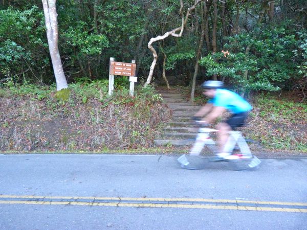
I walked north on Paradise Drive, and passed the County of Marin Tiburon Uplands Nature Preserve trailhead (a small sign and a set of stairs disappeared into the wooded hillside). A minute later I walked past the Romberg Tiburon Center gate, and and soon thereafter, the Bay Conference Center.


I took lots of pictures of the winding, narrow, tree-lined stretches of Paradise Drive. I stopped occasionally to shoot pictures of items perched precariously on a narrow strip of earth adjacent to the asphalt. This time of year there were plenty of berries, acorns, chestnuts, new tiny green shoots starting to push up from the ground, and the occasional banana slug.

I would have liked to have walked a bit more, but cars and bicyclists have a difficult enough time seeing pedestrians in the daytime on roads like this. Best not to alarm them unexpectedly with your presence at dusk.

I turned around at 3333 Paradise Dr. Toward the end of my walk back, about a half hour before sunset, I enjoyed glimpses of small, pretty coves and sailboats, and golden cliffs, visible between dark, silhouetted trees.

On the way back, I took a slight detour and walked downhill Mar Centro/to Mar East street sign, to a cluster of mailboxes, where I'd stopped on a previous walk. Then I headed back up to Paradise Dr., past my car, to the intersection with Solano Street, where I turned around to walk back to my car again. But, not before spending several minutes admiring the Golden Gate Bridge in the distance, with the sun setting behind it.

Wildlife Sightings:
3 butterflies/moths; 2 little brown jobs (LBJs); 1 banana slug


Thursday, September 20, 2012

Fort Baker - July 28, '12

Walking Distance: 3.2 miles (estimate)
Walking Time: 1 hr., 50 min. (4:40 - 6:30 p.m.)
Start and End Point: Fort Baker, Marin, CA

After a few stops in San Francisco, we headed north and crossed the Golden Gate Bridge. Taking the second exit off Highway 101 after crossing the bridge -- down to Fort Baker, we found a street parking space at Fort Baker. From our parking spot we headed up the hill (back toward the Bridge). Note: these roads are marked in white on the Bay Trail map shown at right, indicating they are not "improved" trails.

We walked up the hill on Bunker Road/Danes Drive -- enjoying the sight of a mother deer and two fawns grazing in the shadows. We took Alexander up to the intersection with the Golden Gate Bridge approach road (to a spot where there was a grate in road near a stop sign -- where I'd left off before). Note: there were a few spots on this paved section of curvy road where it's fairly narrow, with shared setbacks with bicycles, so walk with caution. On the plus side, the view looking backwards (through a short tunnel) framed the San Francisco skyline very nicely.

We turned around at this grate/intersection, and on way down, took Alexander Road toward Sausalito (not technically part of the trail), until it joined with East Road. We turned right onto East Road (to walk back toward Fort Baker), shown as a solid red line on map. It was great to see the newly improved packed dirt pedestrian/jogger path, separated from the bicycle path on this stretch. (This area had been under construction during my last walk here in 2010.)

On the way down East Road toward Fort Baker, we turned right to climb the packed dirt Eucalyptus trail (Drown Road trail - not shown on map) to its end -- a fence that separated the trail with Alexander (busy road on other side of fence, where we'd walked earlier as it turned out). We then walked down to the Chapel at Fort Baker and took a peek inside. Taking the Chapel Steps Trail, we walked down a set of stairs and returned to the car.

Nice views of the Golden Gate Bridge, Bay, Angel Island and SF City Skyline on this walk.

Thank you to Ken for joining me on this walk.

Wildlife Sightings:
5 little brown jobs (LBJs); 1 robin; 1 hummingbird; 3 deer (mother and two fawns); 5 dragonflies; 6 crows

Sunday, July 29, 2012

Golden Gate Bridge - July 17, '12

Walking Distance: 3.6 mi.
Walking Time: 3 hrs., 47 min. (11:33 a.m. - 3:20 p.m.)
Start and End Point: Marin Vista Point parking lot, Marin, CA

Today was a great day to walk across the Golden Gate Bridge (shown as a solid red line trail on the Bay Trail map). Thank you to Cindy for joining me today. We started from the Vista Point parking lot on the Marin (north) side of the Bridge; and, from there, it was a very short and easy walk to the sidewalk/bridge approach, to walk south across the bridge toward San Francisco.

This (east) side walkway for pedestrians faced inward toward the Bay and City, and offered sweeping views of the San Francisco Bay, Fort Point (at the foot of the SF side) and Lime Point (near the footing/end on the Marin side), San Francisco, Alcatraz and Angel Island. It was a bit crowded, with mixed bicycle, pedestrian and bridge crew work vehicle traffic jostling for position on the east side of the bridge walkway. (The west side (facing west, out toward the Pacific Ocean) was closed, and opened to bicycles after 3 p.m. we were told.)

During my first walk around the Bay, I crossed the Bridge at night, during the colder months. It was too dark to see any wildlife. A highlight of today's walk was looking down into the water, viewing boats that were passing underneath the bridge, and watching harbor porpoises (including a mother and offspring) swim and surface in the waters below. Identifying birds from above was fun as well. Unfortunately, I did not have a working camera charger (and therefore working camera with a zoom lens) on this walk, and was not able to catch the harbor porpoises in action. The porpoises are apparently making a comeback which is great to hear.

The fog drifted across the bridge in drifts during the walk (south) across the bridge, but cleared during our lunch stop at the Information station/gift shop and The Bridge Cafe. We walked a bit around on the San Francisco hillside before walking back to the Marin side of the bridge where we'd parked. There were patches of blue sky and warm sun on our walk back, and cloud shadows drifted over the surface of the Bay.

Wildlife Sightings:
33 sea gulls; 4 harbor seals; 5 harbor porpoises; 1 sea lion; 2 snowy egrets; 2 terns; 2 brown pelicans; 17 cormorants; 2 pigeons; 2 little brown jobs (LBJs); 12 Western/Clarks Grebes (near Fort Point)

Tuesday, July 24, 2012

Marin, Vista Pt., Ft. Baker - July 15, '12

Walking Distance: .8 mi. (estimate)
Walking Time: 50 min. (11:10 a.m. - 12:00 Noon)
Start and End Point: Marin Vista Point (North end of Golden Gate Bridge), Marin, CA

This was a short walk, part 1 of 2 today, from the north end of the Golden Gate Bridge (Marin Vista Point parking lot) to the dirt service road that curves around and goes down under the Golden Gate Bridge.

This curved dirt road (visible from Google Maps insert at right), downhill from the Vista Point parking lot, ends under Highway 101/Golden Gate Bridge, at a controlled access point, where only employees are allowed to pass through a gate). However, it is an excellent vantage point for views down into Horseshoe Bay (on Fort Baker side), across the Bay toward Angel Island and San Francisco, and of the Golden Gate Bridge from the north side.

Note: To cross underneath the Bridge or access Moore Road which turns into Conzelman Road -- and goes through to the Marin Headlands (west side of the Golden Gate Bridge), you need to approach this from the Marin Headlands (west) side, or follow Bunker Road down (north) to Fort Baker - take a right on Murray Circle and stay right to continue on Moore Road. Watch for speeding bicycle traffic coming down the hill. 


After walking back up to Marin Vista Point, we walked a bit farther down toward Fort Baker, turning around just past the intersection with Alexander Avenue.

Wildlife Sightings:
13 sea gulls; 5 little brown jobs (LBJs); 3 swallows; 2 brown pelicans; 2 white butterflies; 1 bumblebee; 1 turkey vulture.

SF, Fort Point - July 7, '12

Walking Distance: 1.6 mi. (estimate)
Walking Time: 2 hrs., 50 min. (12:49 - 3:29 p.m.)
Start and End Point: diagonal (free) parking space, southeast of Fort Point, San Francisco, CA

This afternoon I walked from the paved (asphalt) parking lot area (southeast) to the Crissy Field Warming Hut/Cafe (where I left off on yesterday's walk) and out to the end of the Torpedo Wharf/fishing pier to look for the brown pelican I saw yesterday. After spotting what I'm fairly certain was the same pelican sitting with two fishermen, I turned around and walked up (northwest) to Fort Point.

Fort Point is, as the name implied, is a historic fort located on a point, at the southern end of the Golden Gate Bridge. The Bridge recently celebrated its 75th anniversary. Fort Point pre-dated the Bridge by 70+ years.

I had the chance to see the "International Orange" exhibit (named for the official paint color of the Golden Gate Bridge) at Fort Point.

The exhibit consisted of works from several artists, including a room of period-inspired Fiesta Queens gowns, designed with images representing the different San Francisco Bay Area counties; a collection of tent camera photographs; a beautiful widescreen video projected on a wall of SF Bay scenes; an International Orange "store" -- and many others.

Exhibits were located throughout (on different levels of) the old fort structure, intermingled with historical exhibits.

I concluded my Fort Point visit by climbing up the brick-lined stairwells to the always breezy roof level of Fort Point. The underside of the Golden Gate Bridge, where one can listen to the ker-thumpity thump of cars rushing by above.

After seeing the exhibit, I walked back (southeast) along the narrow, asphalt road (Marine Drive, shown as double yellow lines on the Bay Trail map), toward the Crissy Field Warming Hut/Cafe.

I took the winding trail with flights of stairs leading uphill. The trail was a packed dirt trail in places. I passed some historic signage and enjoyed the view of the Torpedo Wharf below, and saw what might have been some old bunkers.

Eventually I reached the Golden Gate Bridge Information building and store, on the way to the pedestrian/bicycle approach to cross the Bridge. I looked around the store and also stopped at the Bridge Cafe to buy some Icelandic yogurt and chocolate; both structures had been recently renovated.

If you're lucky, you'll see a panoramic view of the Bridge, fog-free from the top of the hill. Or, the tops of the bridge towers could be shrouded in mist, as they were today.

Wildlife Sightings:
27 little brown jobs (LBJs); 3 pigeons; 1 cormorant; 1 brown pelican (same one as yesterday? - on pier/wharf); 5 Western/Clarks grebes; 5 sea gulls

Thursday, January 7, 2010

Marin, Fort Baker - Jan. 7, 2010

Walking Distance: 2.65 miles
Walking Time: 1 hr., 50 min. (in 3 segments, see below)
1.) Golden Gate Bridge, north end, Vista Point, Marin, CA (2:28 - 2:56 p.m.)
2.) Fort Baker, Fishing Pier, Marin, CA (3:22 - 4:30 p.m.)
3.) Fort Baker, East Road, Marin, CA (5:08 - 5:22 p.m.)


Today's walk was broken up into several little fits and starts, some areas not covered by red line (area under bridge, fishing pier, jetty, etc.), all scenic. Due to what I'm sure are security reasons, it appears that you can't actually drive under (or get too close to) the base of the Golden Gate Bridge; although I approached this area on foot, first from top down (from Vista Point), and then from bottom up (from Fort Baker). I also walked all along the shoreline of Horseshoe Cove, and out to Cavallo Point and the old Battery Yates area. Looking back into the Bay (which was shrouded by fog). It was easy to see why early explorers might have missed the true Bay contours for years. Today, I stood out there, and gigantic ships loomed out nearby, steaming in and out of the Golden Gate. Last, I parked up on East Road, and retraced steps to where I'd left off at Battery Yates, and then walked up the road a bit toward Sausalito.

Thank you to the man who brought me a map of the Fort Baker area, from the (closed) Discovery Museum.

Combined Wildlife Sightings (from all three stops/segments this afternoon):
1 hummingbird; 5 little brown jobs (LBJs); 1 deer; 10 pigeons; 25 sea gulls; 2 tennis balls; 18 cormorants; 38 Western grebes; 6 ducks; 2 brown pelicans (flying together); and 1 blur in a bush.

Sunday, January 3, 2010

Golden Gate Bridge, S.F. - Marin, Jan. 3, 2010


Walking Distance: 3.5 miles
Walking Time: 1 hr., 53 min. (4:37 - 6:30 p.m.)
Start and End Point: metered parking, south end of Golden Gate Bridge, San Francisco, CA

It's exciting to cross the line into new counties. Especially so when it involves making that transition via a landmark like the Golden Gate Bridge. The wind died down after dark, and there were fewer people/walkers as well. (The bridge closes to pedestrian traffic at 6:30 p.m.) Night lights make for interesting photos
(although the bridge moves, making perfectly focused shots a challenge).

Wildlife Sightings:
2 sea gulls while still light; however, no sightings after dark.

To Golden Gate Bridge Part #2/2 - Jan. 2, 2010


Walking Distance: .72 mile
Walking Time: 23 minutes (6:35 - 6:58 p.m.)
Start and End Point: Fort Point East Battery (unpaved) parking lot, San Francisco, CA

From this parking lot, Alec and I walked to the Golden Gate Bridge, hoping to make a crossing. However, pedestrians were not allowed on the bridge after 6:30 p.m., so we got as far as the closed gate, then turned back. Too bad, it was a relatively pleasant, non-windy, fog-free evening.

Wildlife Sightings:
None - It was too dark and too late in the evening


To Golden Gate Bridge Part #1/2, Jan. 2, 2010


Walking Distance: .63 mile
Walking Time: 22 minutes (6:07 - 6:29 p.m.)
Start and End Point: Parked near the Warming Hut, San Francisco, CA

It was wonderful to climb up the stairs and path leading up to the Golden Gate Bridge, that is to see the bridge, lit up in the dark. However, a flashlight does help, as there were no lights on this staircase (shown in daylight from a previous day's photo). We also walked along East Battery (which turned) into Lincoln Blvd., to Long Ave. - a curvy short street that ran downhill, back to where our car was parked. I would not suggest walking Long Ave. in the dark either. But, we were eager to get to the bridge at this point.

Wildlife Sightings:
None, too late and dark.